A study has found that shore-fast ice, which consists of 12% of global sea ice cover, is under serious threat due to climate change. Along with their rapid retreat, polar regions are experiencing melting glaciers and ice sheets, permafrost
thawing and hydrologic cycle intensification.
Little is known about the drivers that break up shore-fast ice or its response to climate change. However, thousands of Indigenous communities rely on this ice to support their homes, livelihoods and cultures. Three to nine months of the
year, arctic communities conduct traditional fishing and hunting on the shore-fast sea ice of the Arctic Peninsula.
Shore-fast ice is ice that is fastened to coastlines, sea floors or to grounded icebergs. It often expands across the ocean surface during the colder seasons and plays a large role in anchoring floating sea ice to land masses. Although it
is natural for shore-fast sea ice to retreat during the warmer seasons, new studies have found that the extent of this retreat, as well as the season it tends to occur in, is rapidly increasing with warming air temperatures.
These ice masses provide vital land habitat for seals and polar bears. It also attracts a diverse range of marine animals, such as fish and whales, due to the ecological productivity of the polynyas formed there; polynyas are open areas of
water that are surrounded by ice. Polynyas are often regarded as one of the most productive marine ecosystems worldwide.
For one, they provide air access to marine animals which live under the ice sheets, leading to a high density of biodiversity in the same area. According to the National Snow and Ice Data Center, the overturning of water that occurs at
polynyas also causes aeration and a constant flow of nutrients within the water, allowing phytoplankton to thrive there—and phytoplankton are the basis of marine food chains.
‘The extent of [shore-fast ice] retreat, as well as the season it tends to occur in, is rapidly increasing with warming air temperatures.’
Even since the early 2000s, communities depending on Arctic shore-fast sea ice have been noting that the ‘ice is thinner, freezes later and has been breaking up earlier than in the 1990s’. This is threatening
their socioeconomic and cultural livelihoods.
It is difficult to track timescale changes in shore-fast sea ice coverage. More detailed studies have mostly been conducted and limited to Northern Alaska, on the coastline near Utqiagvik. Additionally, it has been difficult to track and
model the long-term impacts of shore-fast sea ice retreat and how this will affect the people that live there in the next decades.
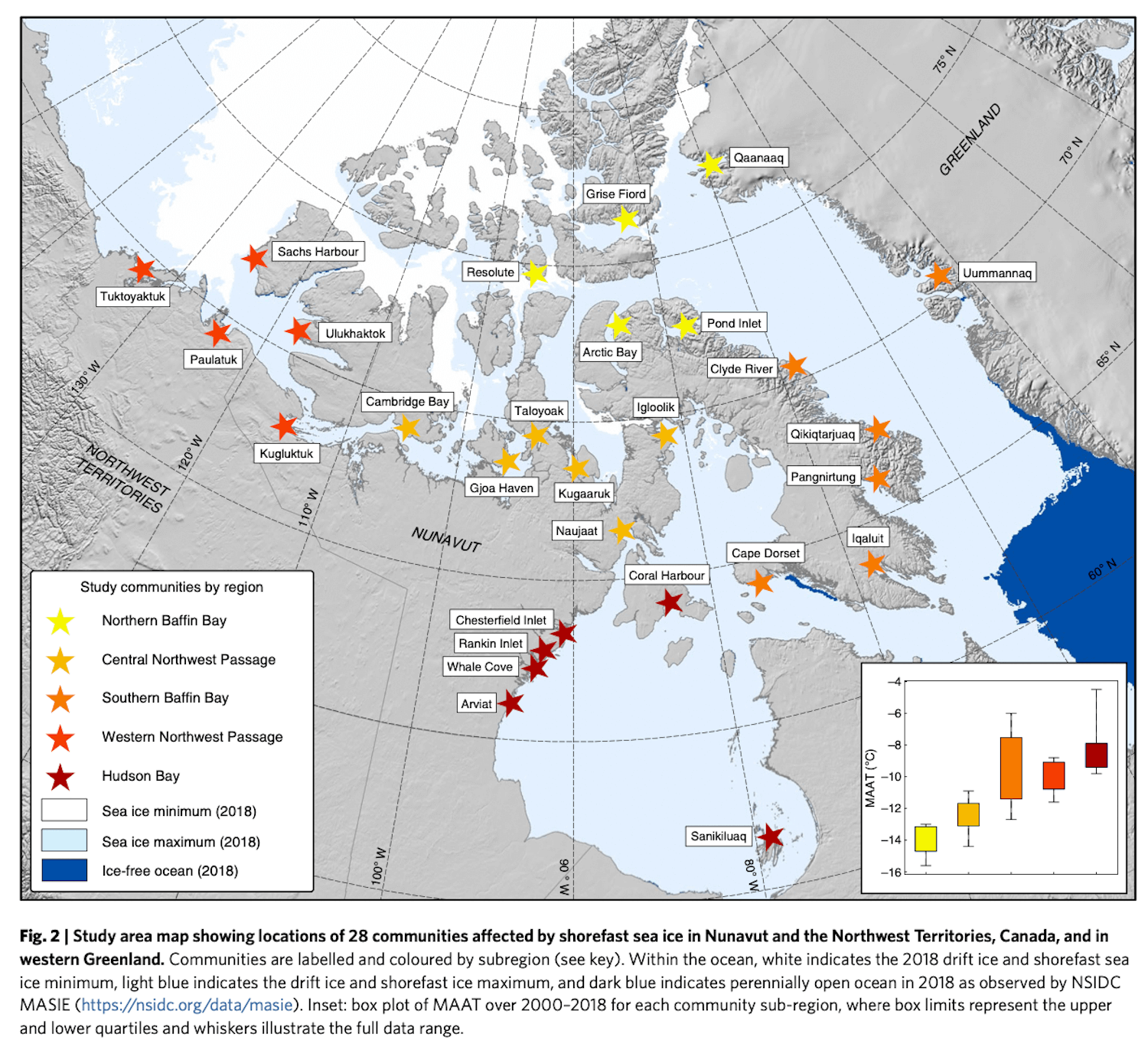
Sarah Cooley and her team used 19 years of daily satellite data in order to track the changes in the shore-fast sea ice areas that support 28 Northern Canadian and Western Greenland communities. Not only does the shore-fast sea ice connect
isolated communities, allow for transportation and support subsistence activities, but it is also effective in mitigating coastal erosion that would otherwise threaten Indigenous peoples as well.
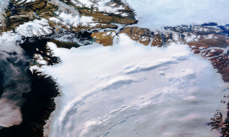
Figure of the study area taken from Cooley et al. paper. | Cooley (2020) / Nature
The data was obtained via NASA’s Moderate Resolution Imaging Spectroradiometer (MODIS), which detects passive microwaves emitted by the sea ice. This method has the drawback that these energy levels tend to be quite low and harder to pick
up, and that they cannot detect details of sea ice composition. However, a benefit of spectroradiometers is that they pass through clouds and can detect sea ice cover in both the day and the night.
Another critique is that the MODIS-aqua sensor had documented uncertainties even before it launched, and that during its mission lifespan, the ‘radiometric response of its 412 nanometer band had degraded by 40%’.
The area observed in the study included communities in the Nunavut and Northwest Canada territories, as well as in Western Greenland. Team compared the MODIS satellite data to surface air temperatures recorded by automated weather stations
(AWS), in order to find any trends between sea ice retreat and local temperatures.
‘The ‘radiometric response of the [MODIS-aqua] 412 nanometer band had degraded by 40% during its mission lifespan.’
The team found that the breaking up of shore-fast sea ice in the Arctic was most associated with the warmer springtime air temperatures. The time period where shore-fast sea ice breaks up at the highest rate occurs between May 29th (+/- 17
days) in Uummannaq, central-western Greenland, and August 1st (+/- 10 days) in Grise Fiord, the southern tip of Ellesmere Island in Canada.
Within the study area, the Cooley et al., found that the ice would start breaking up the earliest in the Western Northwest Passage and latest in the Central Northwest Passage. The mean number of days that shore-fast ice would
break-up lasted 34 days across all 28 communities, with 16 days being the shortest timespan in Tuktoyaktuk and the longest a 76 day timespan in Ulukhaktok, both located in the Northwestern Canadian Territories.
The variability in shore-fast sea ice seasons between these communities was largely due to the local fluctuations of springtime air temperature recorded at each AWS. The results indicate that various locations and communities are affected
differently by shore-fast sea ice decline, with some experiencing much longer periods where the ice is breaking up and others being more sensitive to the air temperature fluctuations that drives it.
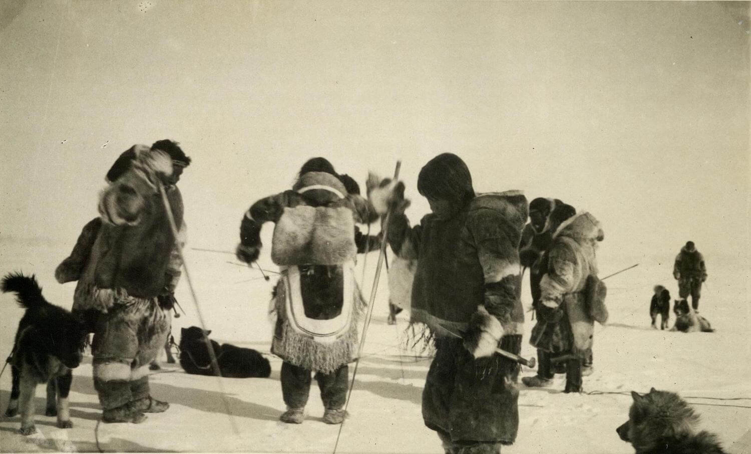
Netsilik inuit hunting after having travelled across shore-fast sea ice via dogsleds. | Nationalmuseet / Flickr
With the current trends of climate change, springtime air temperature is expected to increase dramatically in the coming years, significantly affecting the activities of the communities living there. Even though the shore-fast sea ice of
the communities in the coldest locations breaks up later than the warmer ones, they should still expect large reductions in their shore-fast ice to come.
Northern Canada and Western Greenland are occupied by a large diversity of Inuit and Inuvialuit communities. According to the PEW Charitable Trust (2021), 36,000 Inuit and Inuvialuit live in the Inuit Nunangut—which is a term for the land,
water and ice of northern Canada.
As the cold, barren landscape of the Arctic Peninsula is not suited for agricultural production, Inuit and Inuvialuit communities heavily rely on subsistence fishing and the hunting of arctic char, seals, caribou, as well as polar bears,
narwhal and beluga. The meat and fat of these animals provide a dense source of nutrients and vitamins, in order for these communities to survive the cold environment. Non-edible parts of their catch are fully utilised, using furs and skins
to create clothes or products that are traded between local hunters.
‘Inuit and Inuvialuit communities heavily rely on subsistence fishing and hunting.’
The thinning and retreat of shore-fast sea ice does not only threaten the hunting activities of Inuit and Inuvialuit people, through the loss of the habitat of the animals they hunt, but also their main modes of transportation. Shore-fast
sea ice connects isolated communities, however, if the ice continues to retreat and thin out, travelling across it will become more and more dangerous.
Activities, such as hunting, dog sledding, ice fishing and more, are all deeply integrated within Inuit and Inuvialuit history and culture. Not only will the loss of shore-fast sea ice be a physical loss, but also a significant loss of
their identities.
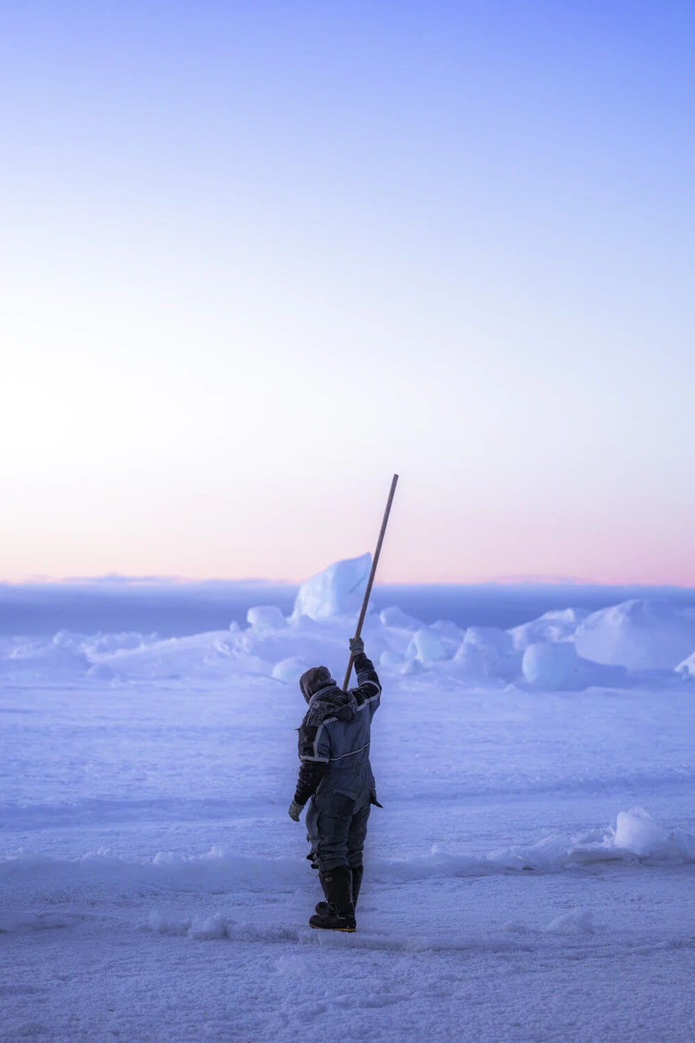
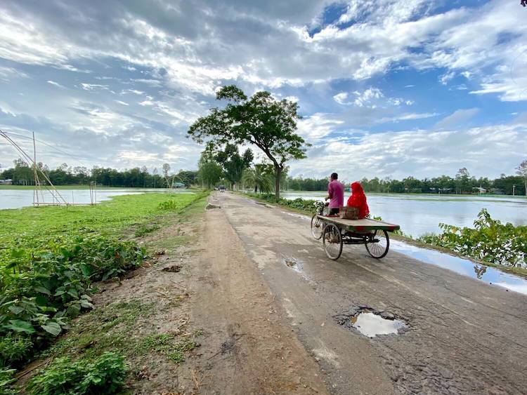
Featured Image: Markus Trienke | Flickr
Cooley S., Ryan J., Smith L., et al. (2020) Coldest Canadian Arctic communities face greatest reductions in shorefast sea ice. Nature—climate change.Volume 10, pages 533-538.
Franz B., Kwiatowska E., Meister G. and McClain C. (2008) Moderate Resolution Imaging Spectroradiometer on Terra: limitations for ocean color applications. Journal of Applied Remote Sensing. Volume 2, issue 1.
Steiro V., Ryan J., Cooley S., et al. (2021) Changes in sea ice travel conditions in Uummannaq Fjord, Greenland (1985–2019) assessed through remote sensing and transportation accessibility modeling.
Polar Geography.